A weather app for iOS and Android
Weather, piped
Weather, piped
straight to your brain.
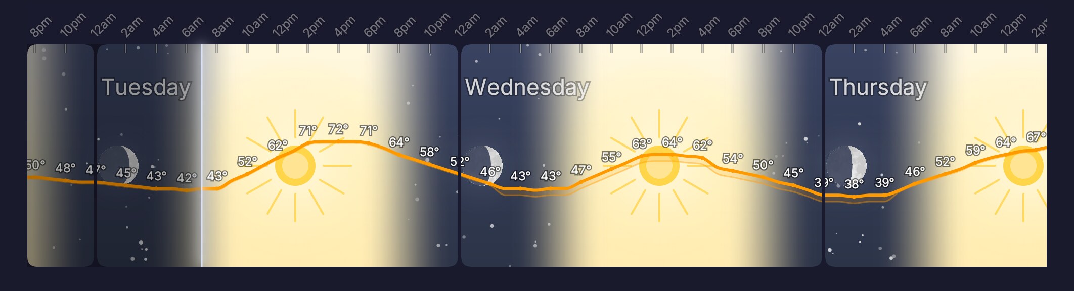
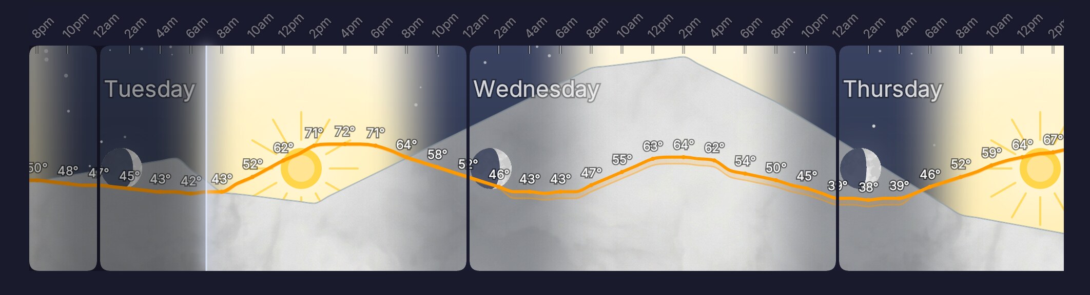
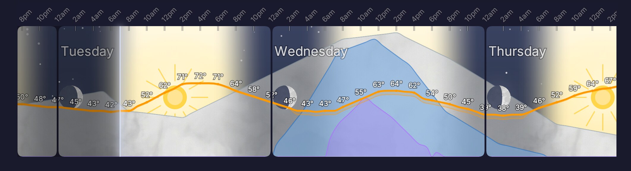
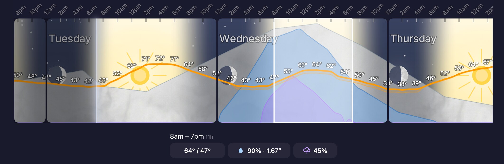
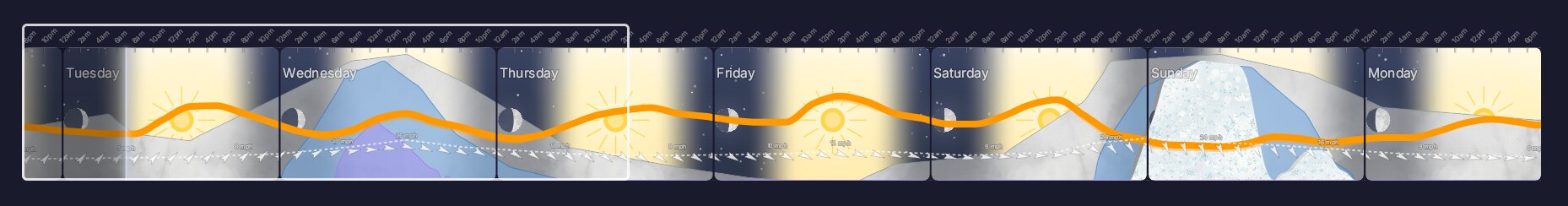
Your brain reads pictures faster than tables. Weatherpipe draws the next few days (or the whole week) as one continuous picture — so deciding when to walk the dog, mow the lawn, or grab a jacket takes five seconds, not five taps.
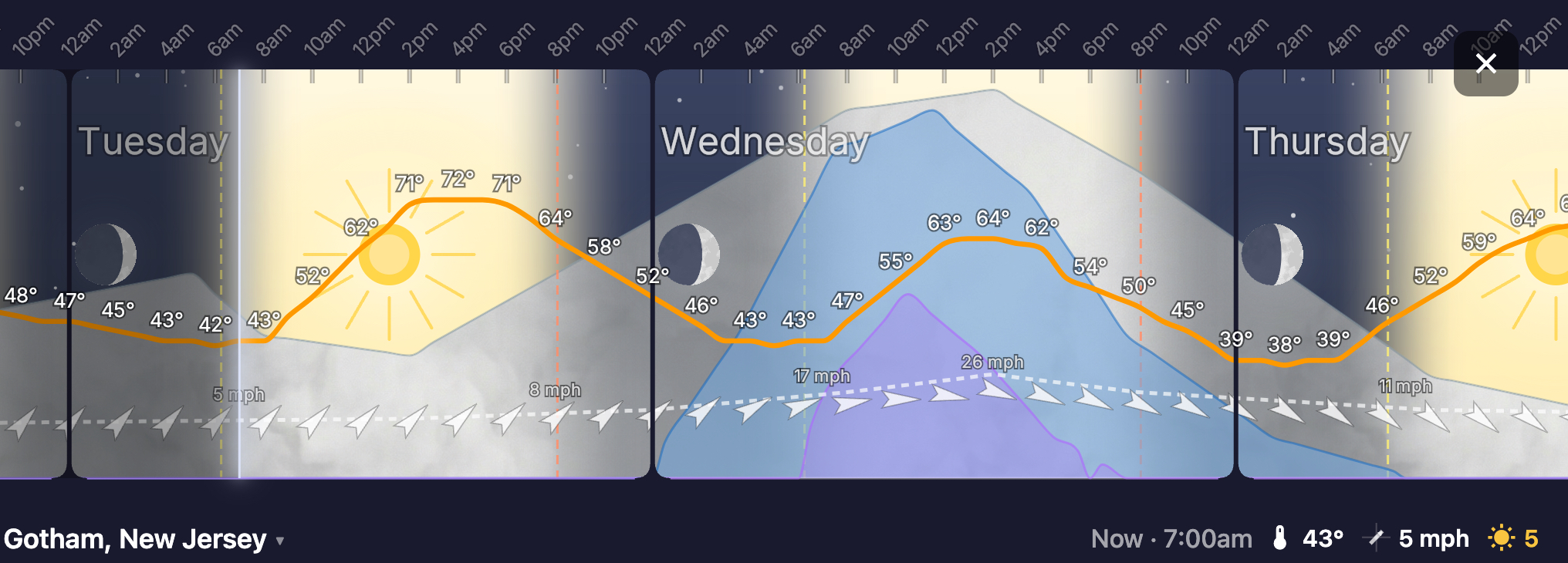
What you're looking at
Once you have the hang of it, Weatherpipe is intuitive. Here's how it works —

Available on
App Store & Google Play.
$14.99/year or $59.99 lifetime. 7-day free trial.
- System
- iOS 15+ & Android 9+
- Size
- Lightweight — no bundled media
- Network
- Required on launch & refresh
- Location
- Optional — search by city or postal code